Planning a sweeping tour of Utah’s national parks? You are most likely considering what makes each one unique and how to capture that with a limited amount of time. Bryce Canyon National Park is a standout in its own right and shouldn’t be skipped. Whether you are coming from Zion National Park or heading in from a gorgeous drive along American’s Highway Scenic Route 12, don’t miss the beauty of this landscape. It can easily be enjoyed in one full day.
Some of the links in this post are affiliate links. This means if you click on the link and purchase the item, we will receive an affiliate commission at no extra cost to you. All opinions remain our own.
Table of Contents
About Bryce Canyon
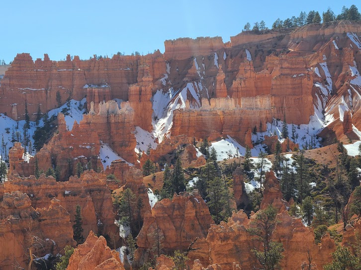
When visiting Bryce Canyon, you won’t be alone. The park sees an average of over 2.6 million visitors a year. The bulk of visitors arrives between May and September. If visiting with your tribe during peak season you could be sharing a trail or the scenic drive with quite a few people. Having a Bryce Canyon itinerary is important to help you negotiate these crowds and have the best day.
What draws all these people are the land features called hoodoos. These features form when softer rock erodes away over eons of time leaving harder stone behind. Each of your highlighted spots in this itinerary will showcase the beautiful results of this ongoing erosion of rock.
Get Your Travel Goals Newsletter & BONUS Workbook
If Bryce Canyon is a stop on your larger Utah road trip itinerary check out our helpful post on how to get the most out of Capitol Reef National Park.
How Many Days in Bryce Canyon
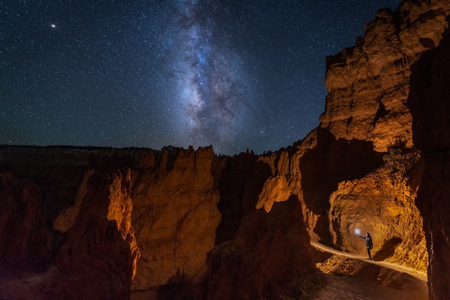
This Bryce Canyon itinerary assumes a certain level of energy and an interest in a few easy-to-moderate hikes all done in one day. This plan takes you from tip to tip across the park. You’ll see it all from Bristlecone Loop to the Mossy Cave Trail. But you can easily adjust by adding another day to take a longer, more strenuous hike such as Fairytale or Peekaboo Loop (which were closed when we went). You could return to the park at night and enjoy a Constellation Talk with one of the rangers, or schedule a horseback ride. You could split our recommended spots over two days and have an even more relaxed experience.
Tip: If you would like to tackle more adventurous hikes then be sure to check out our article covering things you must know about hiking safety and children.
Sunrise in the Park at Sunset Point
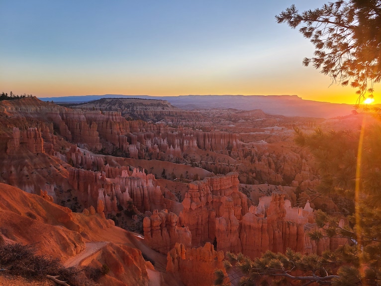
Our number one Bryce Canyon tip is to get started early. Crowds tend to peak by 9 or 10 AM at the latest at national parks and they don’t slow down again until 6ish at night. Getting in early gives you an opportunity to see top sites and more areas of the park without the crowds. If you plan to arrive before the fee station opens at 8 AM (which you will because you’re smart like that) then be sure to have your park pass visible in your car for park rangers to see.
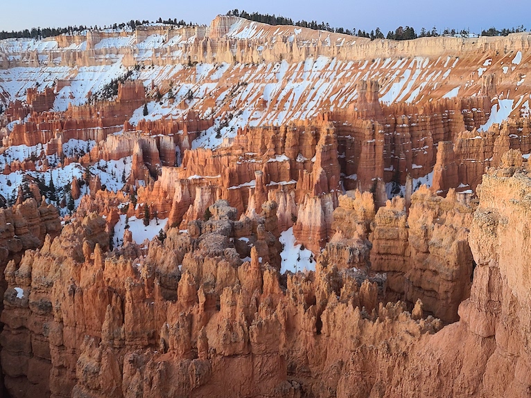
We arrived at 6:30 AM and were the second car in the Sunset Point parking area. It may seem counterintuitive to head straight to a place labeled Sunset Point for a sunrise moment but trust me, my friend. It is a beautiful spot to watch the sun’s rays crawl out from behind the mountains and slide along the hoodoos. You can grab gorgeous photos of the amphitheater from multiple spots along the Rim Trail between Sunrise and Sunset Point. And we noticed we could skip the crowd at Sunrise Point if we stayed put along the trail closer to the Sunset Point area.
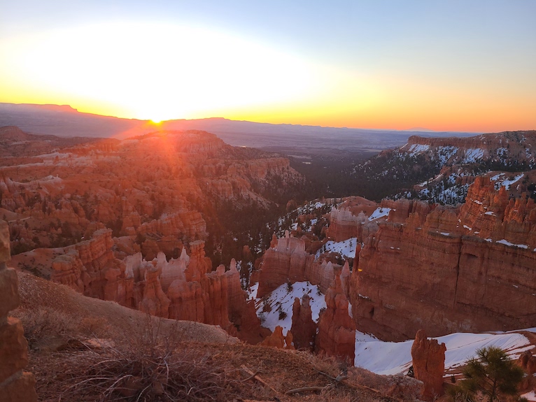
Our favorite photo spot was definitely at the edge of Sunset Point itself. This vantage point gives you a view of a smaller section of the amphitheater up close and personal to your right side. Then you have sweeping views of the whole amphitheater to your left. The sunlight floats across the space, giving you a very special experience.
Get Your Travel Goals Newsletter & BONUS Workbook
Tip: Sunset Point is also the entry to Navajo Loop Trail. If you are stretching this itinerary over two days, you could start the Navajo Loop Trail from here just after sunrise and connect to the Queen’s Garden Trail for one of the most popular experiences in the park. For more details about hiking the Navajo/Queen’s Garden Loop read our article.
Scenic Drive – Begin at the End
If coming to the park in late March or later into the warmer months, the scenic drive should be open for all 18 miles. Be sure to check the park website for current conditions and any closures. Drive all the way to the furthest southern point of the Scenic Drive. Notice as you drive that the crowds thin out quite a bit. You will be tempted to stop along the way but just keep going. You’ll have time to enjoy each point on the way back down. At mile marker 18 the road dead ends at Rainbow Point. Find parking toward the top of the lot.
Bristlecone Loop Trail and Yovimpa Point
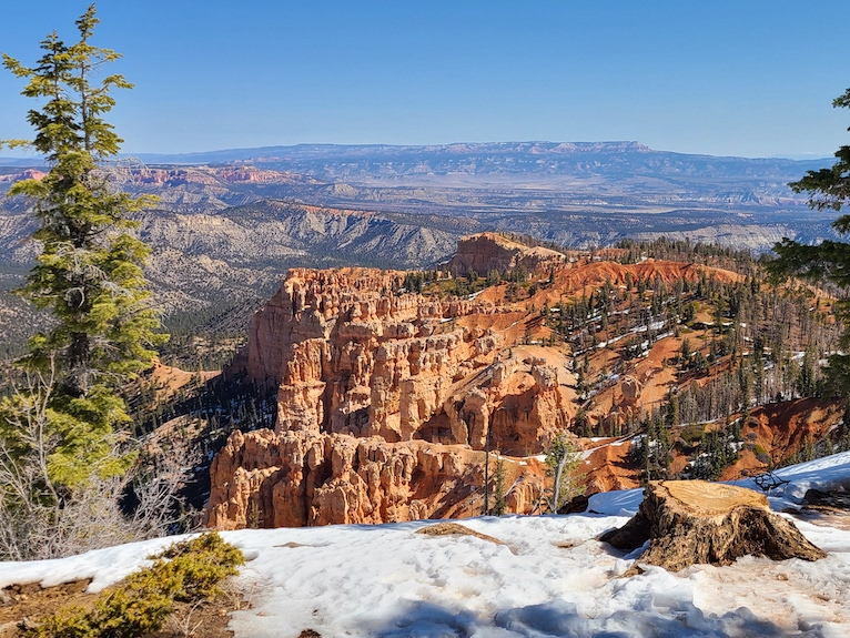
From the top of the lot, you can connect to the Bristlecone Loop Trail, an easy 1.0-mile round trip path through bristlecone pines and views toward Grand Staircase Escalante National Monument. This is the highest point in the park at 9115 feet elevation. When we went during early Spring there was still snow and ice over much of the path.
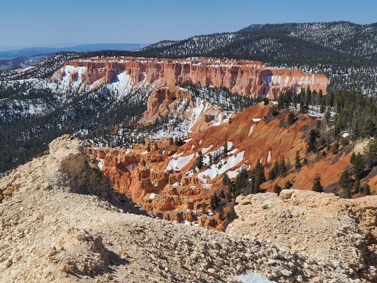
Yovimpa Point is close to the entry to the parking lot. It’s an easy paved path to more impressive views across a crescent-shaped expanse of hoodoos and eroding cliffside. You can appreciate how the forest-green pines pepper the red stone and stand in stark contrast to the lingering snow.
Get Your Travel Goals Newsletter & BONUS Workbook
Ponderosa Point and Agua Canyon
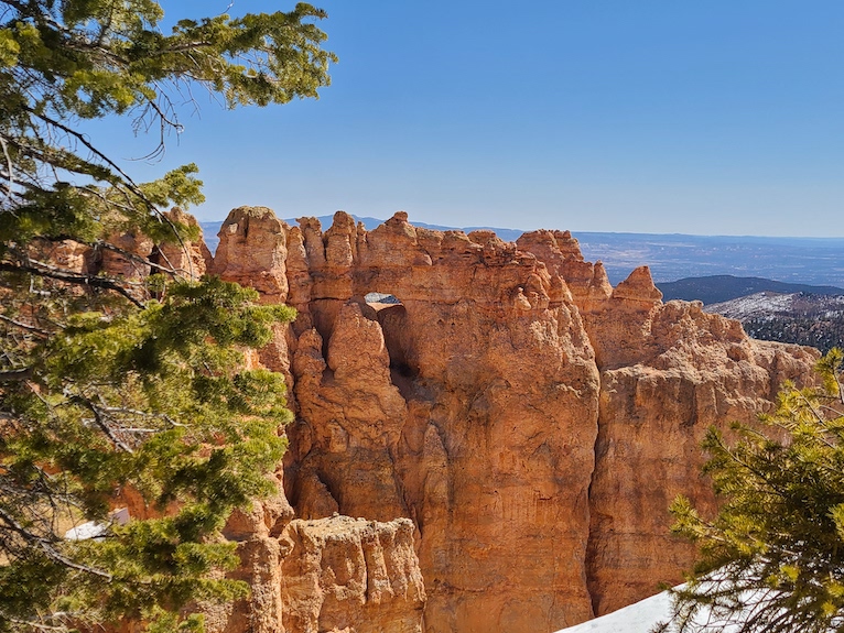
After enjoying the Rainbow Point area, you’re back in your car to head north on Scenic Drive. Your first stop is Ponderosa Point. This is just past mile marker 15. This stop is followed by a pullout for Agua Canyon. There is a connecting trail from here to the Under the Rim Trail which stretches 22.4 miles from Rainbow Point all the way to Bryce Point. But this connection was closed while we were there.
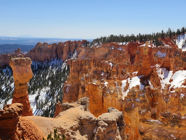
Natural Bridge
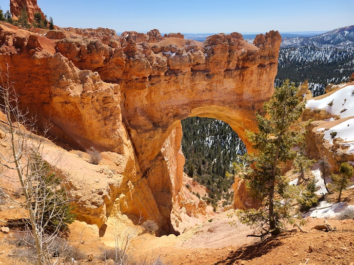
The gradual decrease in elevation has brought you down to 8627 feet and the Natural Bridge overlook. This pullout is just before mile marker 12 and was by far the most crowded of the overlook points on this list. But with a bit of patience, you will be able to get uninterrupted views of this beautiful land formation.
Swamp Canyon
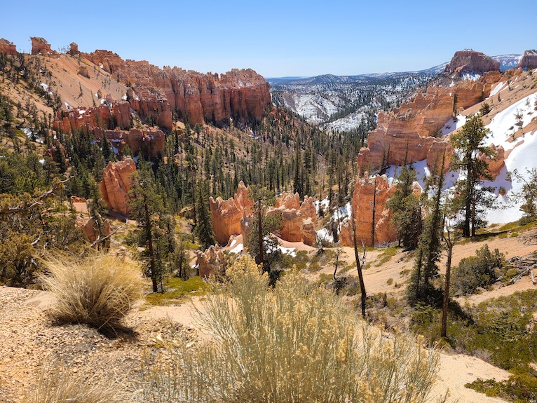
Your last pullover is close to mile marker 6 at Swamp Canyon. From here you can find the trailhead to a moderately challenging backcountry hike that connects to a small section of the Under the Rim Trail and loops back on the Sheep Creek connecting trail for a total of 4 miles and a 647-foot elevation change.
Bryce Canyon Amphitheater Area
You and your tribe will probably want food at this point. So head into the Bryce Canyon Lodge for lunch. It has a wide variety of good food and reasonable prices. But if you’re on a budget, feel free to skip the $7.50 a scoop ice cream counter. You can order from the restaurant inside and have someone from your group try to snag a table in the courtyard. Here you can enjoy a break in the sunshine of the sheltered square.
Get Your Travel Goals Newsletter & BONUS Workbook
Tip: The overflow parking lot just past Bryce Canyon Lodge also has an easy connecting pathway to the Rim Trail right between Sunrise and Sunset Points. So later, if you can’t find parking in either of those more popular lots, you might be able to there.
Trip to the Visitor Center
Because Bryce Canyon Amphitheater area is a very popular part of the park and you’ve reached a peak point in the day for visitors, you may notice you’ve caught up with the crowds. Parking lots are more crowded. As you drive past Sunset Point turn off on your way to the Visitor Center don’t be surprised if there are traffic cones out and signs reading “Parking Lot Full.” Not to worry – you’ve got other things to do. Peak congestion usually starts to ebb after 2 PM. Give yourself a little more downtime with a trip to the Visitor Center.
You may note a long line outside the Visitor Center doors. In response to COVID-19 they are regulating the number of people allowed in the building at any given time. So as people leave that same number of people are let in. Masks must be worn while in line and when shopping. Don’t be concerned about the size of the line because it moves quickly. Rangers are also stationed outside and you can hear the information they share with other park guests as you wait.
Hike Queen’s Garden Trail
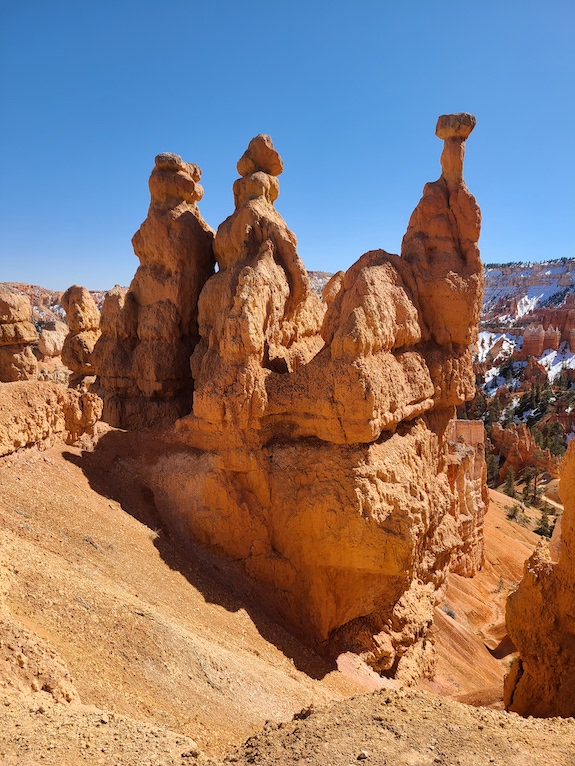
By this point, it’s later in the day and you may be able to get a parking spot in either the Sunset Point lot or ideally the Sunrise Point lot, or possibly the overflow lot mentioned earlier by Bryce Canyon Lodge. Your goal is to walk a bit of the Rim Trail you may have missed at sunrise and get to the trailhead for Queen’s Garden Trail. Sunrise Point lot will get you closest to the trailhead.
Get Your Travel Goals Newsletter & BONUS Workbook
This is the most popular hike in the park as it is one of the easiest ways to get down among the hoodoos of the amphitheater. The Queen’s Garden is a moderate 1.8. mile hike with 357 feet elevation change. This can be combined with the Navajo Loop Trail for a 2.9 miles total hike.
Tip: To get more detailed information on how to best enjoy a hike of the Queen’s Garden/Navajo Loop Trail read our article.
Mossy Cave
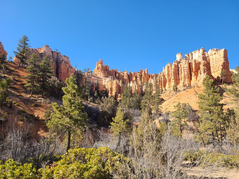
Still have energy? You can head out of the park and from Bryce Canyon City on Hwy 63, turn right onto Hwy 12. Just under 4 miles from the city you’ll see signs and a parking lot announcing the Mossy Cave trailhead. This is still considered inside the park so keep your park pass out and visible inside your car.
Follow the 0.8 mile round trip trail across a small bridge and along a stream. Then fork left to see the cave or follow the right side trail to a small waterfall (or dramatic icicles in the colder months).
Where to Eat
Head into Bryce Canyon City or Tropic for dinner. We enjoyed a minimal wait at the Ruby’s Inn hotel restaurant. They have reasonable prices, good service, and great food. Round up the cost of your meal to donate to the Bryce Canyon National History Association and help support the national park.
Tropic restaurants had great reviews but much longer waits. And we couldn’t track the logic at one restaurant that said guests could not skip the wait time to order to go. If the wait for sit down was an hour and a half then you have to wait an hour and a half to place your to-go order. Huh?
Where to Stay
We stayed at the Best Western Plus Bryce Canyon which had a hot breakfast included. This could be sit down or to go as you please. Very helpful if some members of your tribe take a bit longer to get ready than others. You can run down and grab their meals and they can eat on the go. Breakfast opens at 6:30 and runs until 9:30 AM. There was a significant line by 8.
Best Western Plus Ruby Inn is right across the street and connected to an entire one-stop shopping center. Here you have access to everything you need – groceries, restaurants, hotel, campsites, RV park, and rental equipment for outdoor activities or even horseback riding. This hotel group is still managed by the same family of the original rancher Reuben “Ruby” Syrett, who bought a ranch nearby in the early 1900s.
Get Your Travel Goals Newsletter & BONUS Workbook
When you are ready to keep the Utah adventure going and plan for more adventure by exploring Arches National Park. To get the most out of your experience check out our detailed itinerary.
